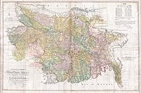
The most important factor dominating the river history in Bengal is the large proportion of silt carried by its rivers. It is the silt which has created the land and made it habitable by building it up through the centuries. It is silt which is fertilising the land, but the silt, which has been the most beneficial gift of nature, has also produced most of the river problems now confronting the people of Bengal. Silt deposited in the old river channel beds has forced them to change course, creating problems for abandoned areas while assisting in developing new areas.
The main volume of water from the Ganges River began flowing through the Padma channel in the sixteenth century. Silt from the Padma helped in building up the southern portion of north Bengal. This is the most plausible explanation for the existence of a depression around Chalan Beel. The Teesta was active in the region until it changed its course in 1787. This territory lies in between the land raised in the north by the Teesta system when it was active and that in the south by the Padma.[5]
However, there is another explanation for the creation of the depression. The Padma has been changing its course over the centuries. In Ven den Brouck's map of Bengal, prepared in 1660, the main channel of the Padma is shown as flowing through Faridpur-Bakharganj, but there also is a suggestion of another, possibly earlier channel. This channel runs through Rampur Boalia in Rajshahi, Chalan Beel, Dhaleswari and Buriganga before meeting the Meghna. At that time the Jamuna was virtually non-existent and the Brahmaputra used to flow through its old channel.


No comments:
Post a Comment